
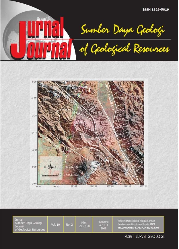
MORFOGENETIK DAERAH LUBUKSIKAPING PROVINSI SUMATERA BARAT
DOI:
https://doi.org/10.33332/jgsm.geologi.v19i2.195Abstract
The landscape of Lubuksikaping and the surrounding area is belong to the Barisan Mountain Range. In general, it had been built up by Structural Ridge, Volcanic Cone Remnant, Volcanic Cone, Structural Valley and Alluvial Plain. Those landscapes are devided into landforms based upon their genetic. It is interested to know that the landform in the western part of Structure Valley is more complexes compared to that of the eastern part. The westernpart landform is composed of several land form such as Fault Scarpment, Volcanic Cone, Volcanic Cone Remnant, Denudated hilly structure), Aluvial Fan and Aluvial Plain, while in the eastern part, the landscape mostly consists of Denudational Hill. These mean that the western part of studied area is being more dynamic. Based on those data mentioned above, it can be deduced that the landscape of this region has been influenced by volcanic and regional and or local tectonic activities, as well as by weathering, erosion, and sedimentation processes
Â
Keywords: landscape, landform, regional tectonic, local tectonic
Downloads
References
Djuhanda A, I. Effendi, A. Djuhanda, T. Padmawijaya , 2004. Laporan Pemetaan Seismotektonik Lembar Lubuksikaping Sumatra Barat Skala 1: 250.000. Laporan Teknis . Pusat Survei Geolgi Bandung, Tidak terbit.
Kalili J.A., & Hehuwat F., 1967. On occurance of large transcurrent fault in Sumatra, Indonesia, Journal Geoscience Osaka University
Katili J.A., 1989. Evolution of the Southeast Asian Arc Complex. Geologi Indonesia. Majalah Ikatan Ahli Geologi Indonesia Vol. 12. no.1
Lumbanbatu U.M. dan Moechtar H., 2002. Karakteristik kegempaan sebagai acuan pengembangan wilayah daerah Padangsidempuan, Kab. Tapanuli Selatan Provinsi Sumatra Utara. Majalah Geologi Indonesia Vol.17 No.1 dan 2. Ikatan Ahli Geologi Indonesia
Lumbanbatu U.M., 2005. Kajian Regional Mekanisme Kejadian Gempa Bumi Pulau Sumatra. Jurnal Sumber Daya Geologi, Vol. XV, No. 1, Puslitbang Geologi
Lumbanbatu U.M., 2008. Karakteristik Bentang Alam Daerah Payakumbuh, Sumatra Barat. Jurnal Sumber Daya Geologi, Vol. XVIII, No.2. Pusat Survei Geologi Bandung.
Rock, N.M.S ., Aldiss D.T., Aspden J.A Clarke M.C.G.,Djunuddin A., Kartawa W., Miswar, Thomson S.J., Whandoyo R., 1983, Peta Geologi Lembar Lubuksikaping skala 1 : 250.000, Sumatra, Puslitbang Geologi.
Tjia, H.D, 1970. Nature of displacement along the Semangko fault zone, Sumatra. Jour. Trop. Geography, 30:63-67
Tjia H.D., 1977. Tectonik Depression along the Transcurrent Sumatra Fault Zone.Geologi Indonesia
Verstappen, H. Th., 1985. Applied geomorphological survey and natural hazard zoning, ITC syllabus. The Netherlands, 37 pp.
Zuidam R. A. van., 1985. Aerial photo-interpretation in terrain analysis and geomorphologic mapping. Smits publisher, The Hague, The Netherland 93
Downloads
Published
Issue
Section
License
Authors who publish articles in Jurnal Geologi dan Sumberdaya Mineral (JGSM.Geologi) agree to the following terms:
- Authors retain copyright of the article and grant the journal right of first publication with the work simultaneously licensed under a CC-BY-NC or The Creative Commons Attribution–ShareAlike License.
- Authors are able to enter into separate, additional contractual arrangements for the non-exclusive distribution of the journal's published version of the work (e.g., post it to an institutional repository or publish it in a book), with an acknowledgment of its initial publication in this journal.
- Authors are permitted and encouraged to post their work online (e.g., in institutional repositories or on their website) prior to and during the submission process, as it can lead to productive exchanges, as well as earlier and greater citation of published work (See The Effect of Open Access)


