
PENELITIAN PALEOMAGNETIK DAN GAYA BERAT KAITANNYA DENGAN PEMBENTUKAN FORMASI BATUAN DI SULAWESI SELATAN SERTA HUBUNGANNYA DENGAN SELAT MAKASAR DAN KALIMANTAN
DOI:
https://doi.org/10.33332/jgsm.geologi.v19i5.214Abstract
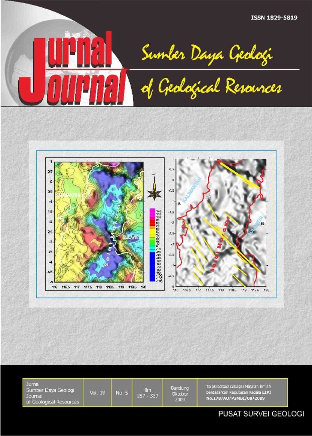
Rocks formed in South Sulawesi consist of: 1. Ultramaphic rocks of Triassic age having the polarity D= 268°, I= -45°, rotation anticlockwise 92°, and paleolatitude position -26.50°S. 2. The melange complexes of Cretaceous age having the polarity D= 330°, I= - 30°, rotation anticlockwise 30° and paleo lattitude position - 16.10°S. 3. Tonasa Formation of Middle Miocene-Early Eocene age having polarity D= 280°, I= -28°, rotation anticlockwise 80° and paleo latitude position -14.80°S. 4. Camba Formation of Middle-Late Miocene age having the polarity D= 279°, I= -24°, rotation anticlockwise 81° and paleo latitude position - 12.5°S 5. Limestones of Tacipi Member from Walanae Formation of Middle Miocene age, having polarity D= 280°, I= -9° rotation anticlockwise 80°, and paleo latitude position -4.5°S. 6. Sandstone of Walanae Formation of Pleistocene age and upper layer having the polarity D= 358°, I= -7°, very small rotation anticlockwise between 0° – 2° S and paleo latitude position -3.5°S. Gravity analysis , Paleomagnetism and GPS analysis indicate that rotation occured in South Sulawesi since Trias until now is anticlockwise. There for rifting concept in Makasar Strait at Recent diagram is less acceptable. Kalimantan and Sulawesi possible had ever closed as indicated from the movement of Kalimantan to the south since Late Trias at -17°S. At the same age Sulawesi moved northward to latitude -16.10°S. Then both islands were amalgamed and moved together northward with anticlockwise rotation between 50° to 92°. During the Trias age Kalimantan was derived from Asian Continent,while rock group in South Sulawesi at the same age were derived from south latitude and then moved together, by Australian continent movement.
Â
Keywords: rifting, paleomagnetic, anticlockwise, latitude, rotation, sea floor, strait.
Downloads
References
Walpersdorf, Andrea, Vigny, Christophe, 1997. GPS Observation of The Tectonic Activity in The Triple Junction Area in Indonesia. Laboratoire de Geologie Ecole Normale Superieure 24 rue Lhomond 75231 Paris, France.
Amante,C., Eakins, 2009. ETOPO 1 Arc-Minute Global Relief Model,. http://www.Nge.noaa.gov/mgg/bathymetry. Charles, Audley, M.G., 1974. Sulawesi MesozoicCenozoic Orogenic Belts, Data for Orgenic Studies Geci. Soc London, Spec. Pub. No. 4: 365-378
Rangin, Claude, Laurent Jolived., Manuel., Pubellier., 1990. A Simple Model for the Tectonic Evolution of Southeast Asia and Indonesia Region for the Past 43 m.y. Bull, Soc, Geol, Frame. 1990. (8). I. VI. (6): 889-905.
Haile, NS., 1978. Reconaissance Paleomagnetic Results From Sulawesi, Indonesia and Their Bearing Paleogeographic Reconstruction. Tectonophysics 45: 77-85.
Katili, J.A., 1978. Past and Present Tectonic Position of Sulawesi, Indonesia. Tectonophysics 45: 289-322.
Mubroto, B., 1988. Paleomagnetic study of the east and southwest arms of Sulawesi, Thesis PhD, tidak dipublikasikan, Universitas Oxford, Inggris, 253 halaman.
Arsana, I Mad, Andi., 2006. The Australia Submission of the Extended Continental Shelf (ECS) A Study on its Impact to the Indonesia – Australia Maritine Boundaries, and Indonesian Potential Claim over ECS.
Muller, R.D.,Roest, J., Royel, I., (1998). Digital Isochrons of the Ocean Floor. http://www.ngdc.noaa.gove/mgg/html.
Sukamto, Rab., 1982. Peta Geologi Lembar Pangkajene dan Watampone Bagian Barat, Sulawesi, Skala 1 : 250.000, Pusat Penelitian dan Pengembangan Geologi, Bandung.
Sasajima, S.,1979. Paleomagnetic with fission-track datings on the western arc of Sulawesi, Indonesia. Journal of Geophysic. Res., 88: 9407-9418.
Sunata, W. dan Wahyono, H. , 1987. Paleomagnetism along Transect VII (Jawa Kalimantan Transect) Preliminary Report of the Jawa-Kalimantan Transect. Geological Research and Development Centre, Chapter VI, 73- 88.
Sunata, W., Wahyono, H., 1995. Data Magnet Purba Teruji Untuk Formasi Tanjung, Daerah Batulicin, Kalimantan Selatan, Pusat Penelitian dan Pengembangan Geologi, Bandung. Publikasi Khusus No.19: 242-252.
Panjaitan, S., Mubroto, B., 1993. Indikasi Tektonik Berdasarkan Data Paleomagnetik di Daerah Soppeng Sulawesi Selatan, Proceedings 22nd Annual Convension Indonesian Association of Geologists, I : 83 – 91.
Panjaitan, S., dan Hutubessy, S., 1995. Penelitian Magnetostratigrafi di daerah Sulawesi Selatan Laporan, Pusat Penelitian dan Pengembangan Geologi, Bandung. Smit., Sandwele., Last Update., 2003. Globe 30†Topografi Overlaid Mesured and Estimated Bathymetry. http://www.ngdc.noaa.gov/mgg/global/.html.
Downloads
Published
Issue
Section
License
Authors who publish articles in Jurnal Geologi dan Sumberdaya Mineral (JGSM.Geologi) agree to the following terms:
- Authors retain copyright of the article and grant the journal right of first publication with the work simultaneously licensed under a CC-BY-NC or The Creative Commons Attribution–ShareAlike License.
- Authors are able to enter into separate, additional contractual arrangements for the non-exclusive distribution of the journal's published version of the work (e.g., post it to an institutional repository or publish it in a book), with an acknowledgment of its initial publication in this journal.
- Authors are permitted and encouraged to post their work online (e.g., in institutional repositories or on their website) prior to and during the submission process, as it can lead to productive exchanges, as well as earlier and greater citation of published work (See The Effect of Open Access)


